Rousay, Orkney: Nabo Fieldschool
Against Time and Tide: Investigating The Iron Age of Orkney (2012)
Introduction
Against Time and Tide: Investigating The Iron Age of Orkney (2012)
Introduction
Staff and Students from the University of Bradford, Orkney College (University of the Highlands and Islands), City University of New York, and the William Paterson University of New Jersey will be fighting against time and tide this summer to rescue as much archaeological information as possible from an eroding archaeological settlement mound at Swandro on the island of Rousay. Information gained from the excavation will enhance our perception of the Iron Age people living in Orkney. The Iron Age is a time of changing weather patterns and it is hoped that information from the settlement about the arable crops, domestic livestock, fishing and hunting strategies will allow us to examine adaptations to these changes and to chart cultural changes associated with the first contact with Viking settlers in the Medieval warm period of the 9th century AD.
The mound was formed by the continuous occupation of the site, over a number of generations, for probably more than a thousand years. Known locally as the Knowe of Swandro, the eroding settlement appears to be focused on a large Iron Age broch; these multi-floored tower like buildings dominated North Atlantic Britain in the time between 400 BC and 200AD. The broch at Swandro is being consumed by the erosive power of the sea. Once securely on land, the site illustrates the changes in sea level over the last two thousand years and the destructive power of the sea. It provides a timely reminder of the threats we currently face with the predicted changes in sea level due to global warming.
The site provides a substantial challenge to the archaeologist as nearly half the circuit of the broch tower is on the beach, much of which is down to the first courses of the building’s dry stone walls. Steve Dockrill and Julie Bond, who are directing the excavation, are hoping that the floor surfaces survive allowing sampling and dating to take place; this will add significantly to the emerging story of human settlement in these marginal zones of North Atlantic Britain.
The Knowe of Swandro
The site at Swandro on Rousay is a mound with obvious stone inclusions forming a multi-period site spanning the Early Iron Age to the Viking Age. The site is being destroyed by coastal erosion and our effort is being concentrated on recording as much information as is possible from the beach at Swandro. The Ordnance Survey thought that ‘the size and shape of this turf-covered mound suggests it to be the NE half of a broch, and a trench cut across it (but now filled in) revealed enough surviving walling to support this classification’ (records on Canmore: RCAHMS 12th report and inventory, p220, no. 579, RCAHMS 1982, p22 no. 72). On its eastern flank is the Norse house site known as Westness (HY32 NE17, Kaland 1993).
Archaeological investigation in 2010 revealed that midden and structural features (walling, paving and orthostats) survived under the storm beach and the intertidal zone.>/p>
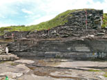
Excavation work in 2010 and 2011 enabled the fuller characterisation of the archaeological survival and the nature of the erosion to be more fully understood. The sea had created terraces within the archaeological mound and these truncated surfaces were then re-sealed by beach material. The formation of these terraces was due to the combination of the resistance of the underlying archaeological material to erosion combined with the height of the beach. Areas near to the low tide mark had suffered more extensive erosion while that at the high tide mark had suffered less and as a consequence later phases of settlement activity survived at the top of the storm beach. The terracing between these zones was facilitated by the protection of flag surfaces and orthostatic settings. The partial remains of the building identified in 2010 formed one of these surviving terraces and dates to the first century BC.
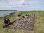
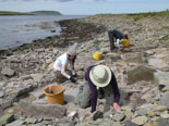
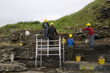
As one climbs up from the low tide zone up the beach to the neap high tide mark one is literally stepping through time. The eroded surface was cleaned in 2011, recorded and extensively sampled. The archaeology on the beach was found to extend significantly in both directions along the coastline to the south east and to the northwest. Midden was also found surviving at the low tide mark. On the north western side of the cleared archaeological surface the remains of a large outer wall was uncovered, forming the arc of a large circular building which conjoins the archaeological remains surviving within the mound. Within the cleared zone (some 8 by 10 metres) the remains of a number of orthostatic settings and several levels of paving were identified with associated midden deposits. The building identified in 2010 had been clearly truncated by the marine erosion. An extensive depth of midden was found to survive near to the low tide mark.
Sampling of the middens has proved that they contain good archaeological potential with carbonised plant remains surviving, added to which there is good survival of animal bone. This site clearly has the potential to supply a dated sequence informing on the changing paleoeconomic resource through the first millennium BC and the whole of the first millennium AD. Preliminary archaeomagnetic dating results from a hearth sealed by the building suggest usage in the second century BC. This appears to be later than the substantial wall arc. The eroding beach is destroying the seaward half of the large circular structure, which possibly represents a broch. The erosion was seen to be particularly aggressive in this zone and suggests that only the lower course of the walls might remain, The western arc, if it survives, is likely to be more fragmented as this seems to be the zone of most aggressive erosion. An important objective will be the excavation, recording and sampling of any remaining floor deposits. This will be carried out in a planned extended excavation season so as to facilitate this objective. The clearance of a zone and stratigraphic excavation of the endangered structural remains on the storm beach extending beyond the south east edge of the 2011 area is also planned, in order to inform on the extent and archaeological survival of possible Pictish and Viking deposits between the Knowe and the Viking settlement.
Background Context
The work at Swandro forms part of an international research initiative between British and American Universities as part of the Orkney Gateway to the Atlantic project. The aim of Orkney Gateway to the Atlantic project is to provide an insight in understanding how the inherited landscape of past inhabitants survived so successfully in such marginal areas for generation after generation, with many of these sites forming the focus for continued settlement over millennia. Due to the northerly position of Orkney, the islands have shorter growing seasons and a degree of marginality, which offers a remarkable opportunity to study the long-term effects of climate change and how people survived and adapted, from the first farmers over 5,000 years ago through to the clearances in the 19th century. Understanding this sustainability and how the people (and society) adapted to climatic and environmental change over time has value to us today as we are facing the effects of global warming. As well as adaptation and sustainability, this long time frame provides the potential to study cultural changes as a result of contact and trade.
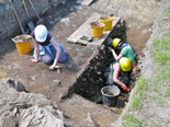
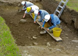
Photographs from the 2011 Fieldschool
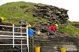
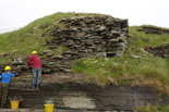
Photographs of 2011's excavation taken by Steve Dockrill:

